Skip to content
Accessibility Agenda Slow Tourisme Brochures

Kämpf Cheese Factory

The brilliant invention: the fondue bag that climbs the summit with you.

Discover
Morges Région Tourisme

Kämpf Cheese Factory

The brilliant invention: the fondue bag that climbs the summit with you.

Discover
Trail along the Venoge river

Trail along the Venoge river

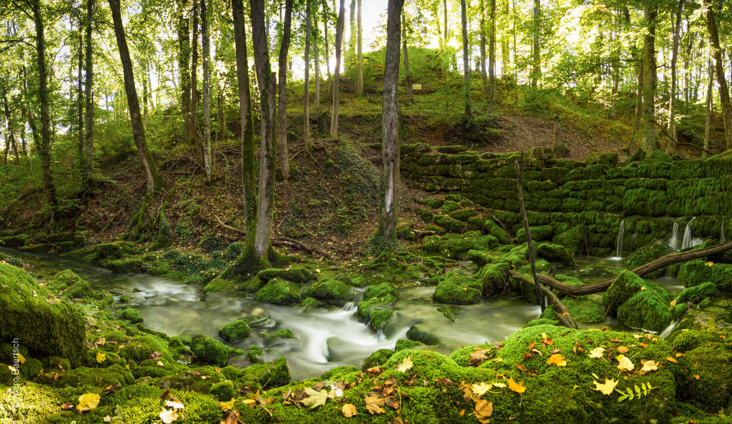
In the shade of the trees, several paths run along the river and allow the visitors to enjoy the local fauna and flora.

Distance
26 km
Duration
7h00
Elevation gain
776 m
Elevation loss
665 m
Difficulty
Medium

Between La Sarraz and Préverenges beach, a path runs along the river Venoge and offers calm places of abundant vegetation.
It is in the village of L’Isle that the Venoge river was born. It continues its slow descent through the forest, countryside and fields to Préverenges, where it reaches Lake Geneva.

Itinerary

Préverenges beach

Avenue de la Plage
1028 Préverenges
Suisse

Open in Google Maps
Echandens

Route de la Gare 4
1026 Échandens
Suisse

Open in Google Maps
Commune de Cossonay

Rue Neuve 1
1304 Cossonay
Suisse

Open in Google Maps
Cossonay temple

Rue des Bons-Enfants 4
1304 Cossonay-Ville
Suisse

Open in Google Maps
Commune d’Éclépens

Rue du Village 24
1312 Eclépens
Suisse

Open in Google Maps
Château d’Eclépens

Château d'En Haut 3
1312 Eclépens
Suisse

Open in Google Maps
La Sarraz

Grand-Rue 1
1315 La Sarraz
Suisse

Open in Google Maps
La Sarraz Castle

Rue du Château 1
1315 La Sarraz
Suisse

Open in Google Maps
La Dérupe

Chemin de Montfens 2
1030 Bussigny
Suisse

Open in Google Maps

Route details

Duration
7h00
Distance
26 km
Elevation gain
776 m
Elevation loss
665 m
Difficulty
Medium
Highest point
573 m
Lowest point
374 m