
Walk to the point of view Croix de Châtel
Discover the beauty of the Jura vaudois from the Mollendruz pass to the mythical Croix de Châtel.
Distance
Duration
Elevation gain
Elevation loss
Difficulty
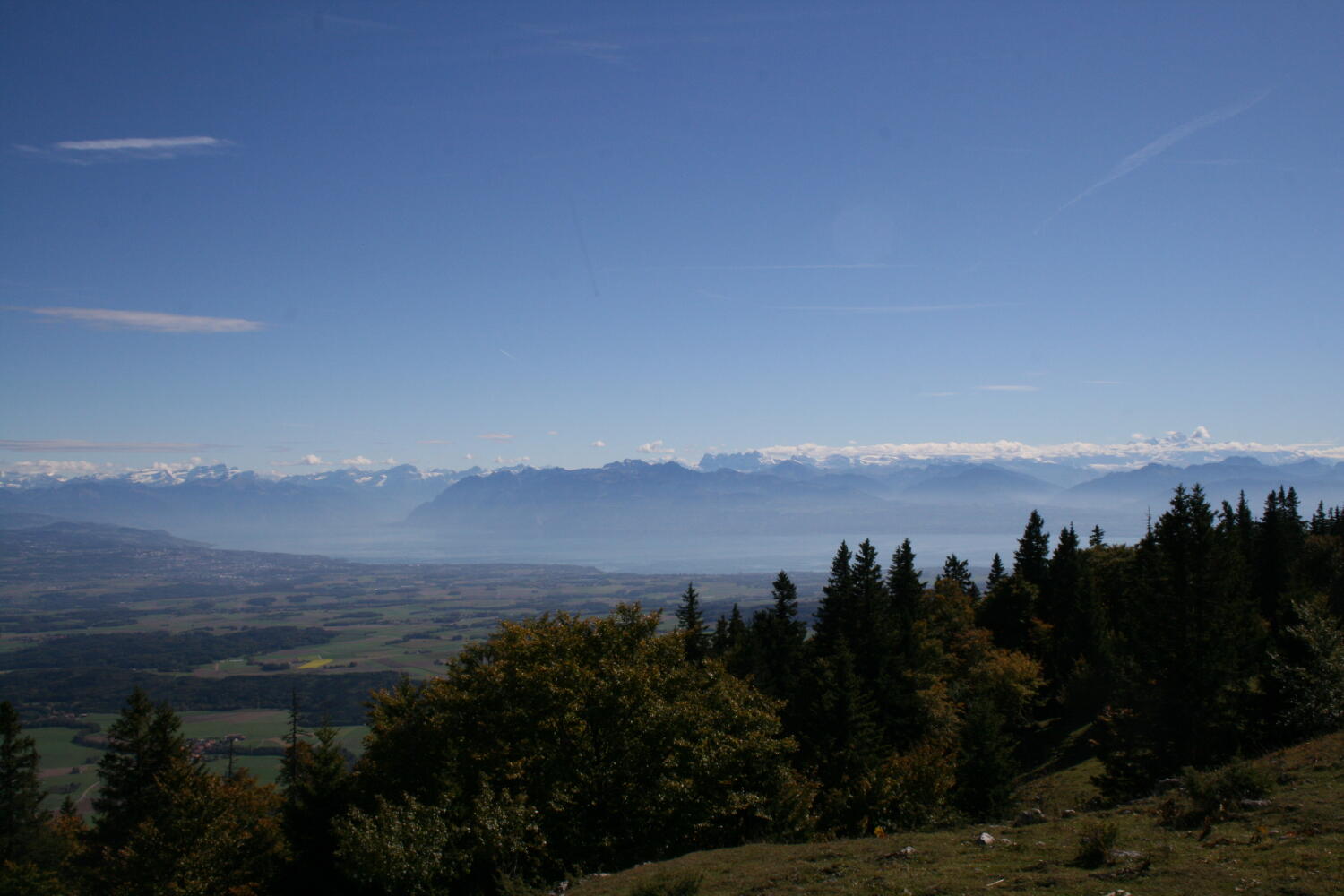
Hikers can enjoy breathtaking views of Lake Geneva and Lake Neuchâtel from the Croix de Châtel.
The return journey to Mollendruz takes you through magnificent forests and pastures.
Through the forest and along the ridge, overlook Lake Geneva and admire a direct view of the Alps. Once you reach the Croix de Châtel, you have a 360-degree view.
Loop 13 km: Departure from the car park at the Mollendruz pass. The trail starts with several passages in the forest, then climbs up a ridge to the Châtel refreshment bar. From the cross, go down towards the Combe du Pré de l’Haut and then follow the old Roman road which takes you to the Buvette des Croisettes. Continue towards L’Abbaye, where you will discover on your left the village of Tipis Madrugada. Continue by taking the Ermitages crossing from where you will enjoy a magnificent view of Lac de Joux and Lac Brenet. When you arrive near Petra Felix, cross the cantonal road twice, then finish the walk along the Combe de la Grande Posogne to your starting point at the the Mollendruz pass.
Shortcut 9 km: Before the Croisettes, turn right to join the chalet of the Jura Club then continue the descent to the Mollendruz pass.
Itinerary
Route details
Duration
Distance
Elevation gain
Elevation loss
Difficulty
Practical Information
Signs: Nordic walking signs (orange/green)
Height difference: 482 m (+) / 482 m (-)
Minimum altitude: 1100 m
Maximum altitude: 1421 m
The hike starts and ends at the Mollendruz pass. If you come by car, you can park at the pass. The journey from Morges takes about 30 minutes.
If you come by public transport, please check www.cff.ch for the exact timetable.